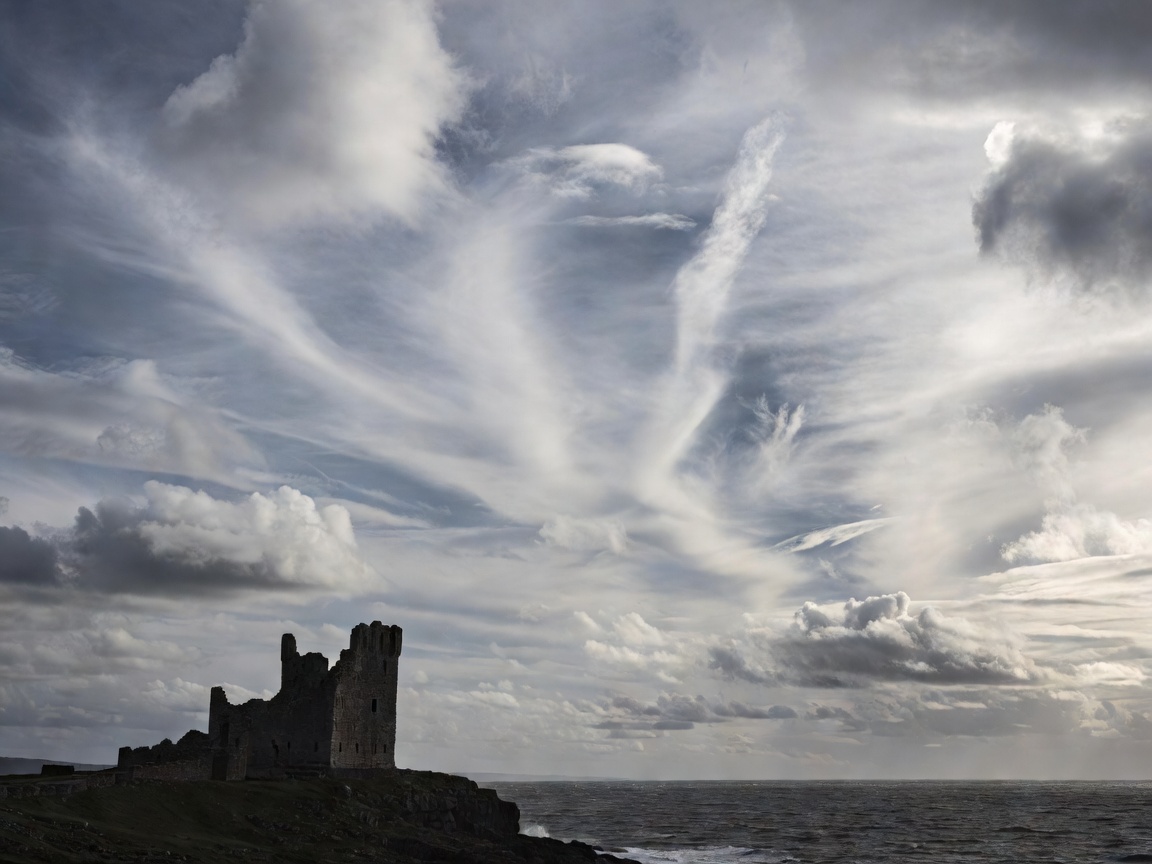
Historical Context & Strategic Magnificence
Begun in May 1313 under the direction of Thomas, 2nd Earl of Lancaster, Dunstanburgh Castle was designed not merely as a military stronghold against Scottish border incursions, but as an overwhelming architectural statement of political defiance against his cousin, King Edward II.
Unlike Bamburgh Castle, which underwent substantial Victorian domestic restoration by Lord Armstrong, Dunstanburgh was never rebuilt into a comfortable home after its devastation during the Wars of the Roses. Besieged twice in the 1460s with heavy artillery, the fortress was largely stripped of salvageable timber and lead, leaving skeletal sandstone and dolerite towers that have weathered sea gales for more than five centuries.
The Great Whin Sill Geological Foundation
The castle's defensive power stems directly from the underlying Great Whin Sill—a vast quartz-dolerite sheet intruded during the late Carboniferous period. On the seaward northern face, sheer cliffs plunge 30 meters directly into the foaming North Sea. The dramatic chasm known as Queen Margaret's Cove cuts deep into the basalt base, where massive swell waters compress within sea caves with explosive acoustic power.
The contrast between the dark, igneous columnar dolerite crags and the honey-tinted Carboniferous sandstone ashlar used for the gatehouse masonry creates exceptional photographic depth, particularly during low winter sunrises.
Photography & Birdlife Tip
The northern basalt sea-cliffs beneath Lilburn Tower host bustling colonies of kittiwakes, fulmars, razorbills, and shags between April and July. Bring binoculars or a telephoto lens, and approach cliff edges with extreme caution as grass verges can be undercut by winter storms.
Walking Approaches & Trail Profiles
Because no vehicle can reach the castle gates, all visits involve scenic shoreline walks across open sheep pasture and boulder beaches:
- The Southern Approach (from Craster): Starting at the historic fishing village of Craster (where public pay-and-display parking is situated in the former quarry), the route follows a level grass track along the rocky shore. Passing through a gated kissing gate, the ruins dominate the horizon ahead for the entire 1.3-mile stroll.
- The Northern Approach (from Embleton Bay): Beginning from Low Newton-by-the-Sea or the Embleton golf links, this approach leads along the wide sand dunes of Embleton Bay. The view of the castle reflected in wet intertidal sands at sunset is considered one of the finest perspectives in Britain.
Comparative Evaluation: Dunstanburgh vs. Bamburgh
Visitors planning their coastal itineraries often compare Northumberland's two premier coastal fortifications. The experience offered by each site differs markedly:
| Feature | Dunstanburgh Castle | Bamburgh Castle |
|---|---|---|
| Atmosphere | Remote, romantic, windswept ruin open to elements | Inhabited, fully furnished stately fortress and museum |
| Vehicle Proximity | Zero road access; mandatory 1.3 to 1.8-mile hike | Direct tarmac car parks right beneath castle walls |
| Footfall Density | Dispersed across coastal paths; peaceful intervals | High tourism volume throughout peak summer weeks |
| Admission & Access | English Heritage / National Trust (Grounds viewed freely from path) | Private commercial ticketing required for grounds & rooms |
Practical Visitor Guidelines
Sturdy walking footwear is recommended year-round, as the pasture paths can become muddy and slick during autumn and winter rains. Cattle and sheep graze freely throughout the National Trust estate surrounding the fortress; all dogs must remain on short leads at all times.